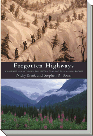
Forgotten Highways
Wilderness Journeys Down the Historic Trails of the Canadian Rockies
Excerpt
Steve and I were skiing west, breaking trail on a crisp January day. We followed a clear but narrow path through the pine forest in the bottom of a wide flat valley near Saskatchewan Crossing. Fresh cougar tracks wound back and forth across the trail – probably from the night before, we convinced ourselves as we struggled up a steep incline of deep snow and emerged onto a windy ridge. We stopped for a snack overlooking the frozen channels of a river that flowed from the head of the valley. Its outlet was hidden from view by the imposing bulk of a mighty ogre-like mountain whose shadow crept over much of the valley. "We could scramble down this hill and just keep on going, it's so flat and open," Steve said. "I wonder where it leads." I looked calmly at him, raising my eyebrows, with my breath crystallizing on my hair and hat. It was a look he knew well, and it translated into, "we're not prepared for that kind of trip and you know it but I won't say so because then I'll seem like the naysayer." What I actually said was "let's check the maps and guidebooks and plan a real trip." We later learned that the enticing valley that curved west and south, and headed to a low pass over the great divide was Howse Pass, Canada's first trans-mountain trade route of the fur trade era, established nearly two centuries earlier and then shut down because of a violent dispute between rival peoples.
We had only just begun exploring the mountains, having moved to Canmore one year before for its fantastic outdoor recreation opportunities. Steve was quite familiar with the region, having grown up in Calgary and having worked for a few summers for the Alberta Forest Service, but he had been away for many years. Originally from Toronto, I met Steve while we were both living in St. John's, Newfoundland. He followed me to Vancouver, then I followed him to Ottawa. After a couple of years, we wanted to clear out of the big city to gain easier access to the wilderness. We decided to make the Rocky Mountains home.
Our first summer in the mountains, Steve convinced me to go on a week long backpacking trip. We had gone on shorter journeys before, but I had always been a bit trepidatious about travelling so far off the beaten path for so long. How would I carry all the weight? Would I miss the comforts of home? It turned out to be a fantastic adventure taking us through some of the premier scenery of the southern Rockies and I was hooked. I loved the feeling of freedom that came from being completely out of touch with everyone and everything I've ever known (except for Steve, of course). No phone, no email, no watch, no itinerary, everything we needed to survive was on our backs and we could go wherever we wanted to go.
Standing on the snowy ridge overlooking the Howse River, Steve had an inkling that a low flat valley like this must have been important at some time. Steve has always been interested in the history of exploration and knew quite a bit about the explorers that had travelled here, but even he was unsure of the exact routes they had taken through the mountains. And so, our journey to discover Howse Pass began in the library. Throughout the winter we immersed ourselves in mountain lore and history, something we had overlooked in our celebration of the wilderness. We were a little surprised at what we discovered. These mountains and hills have a long history of human occupation – from early native travellers and traders, to the explorers of the fur trade, to railway surveyors, mineral prospectors, loggers and finally tourists. This landscape is not, as people sometimes believe, a pristine wilderness untouched by humans that has been preserved for eternity in its original state, primeval and free. I began to appreciate the human presence in the mountain parks, to see how it influenced the development of railroads, highways, and town sites and how geography had a profound impact on the commercial and political development of the west. When we go hiking or driving through the mountain parks, the routes we travel were not created strictly to facilitate modern pleasure and tourism, but represent a significant part of the history and heritage of this part of the world. On road or foot, we are frequently following in the tracks of people for whom the trails were an integral part of daily life, for travel and trade, hunting and communication.
I read a tantalizingly elusive and vague reference in a magazine about someone who tried to locate the route taken by Captain John Palliser and his surveying expedition of the 1850s. Apparently it is not entirely clear where he went and several mountain passes meet the rough description of his proposed route for the railway. How could it be that the route of someone as important to Canadian history as John Palliser remained a mystery? In 1963 The Beaver published an article titled "Routes Through the Rockies" by Irene M. Spry, in which she briefly detailed the journeys and expeditions of many of the West's early pathfinders. After reading this article Steve and I unfolded every map of the mountains we had and draped them over the chairs, tables and floors of our small condo to try and locate the routes of these early adventurers. We were surprised to find that in many cases the most significant original travel and trade routes between east and west, or at least portions of them, ran through the various Rocky Mountain national and provincial parks – they were still trails, sometimes well over 100 kilometres long, reasonably untouched by the advances of civilization. People occasionally hiked them for the wilderness experience they provide, but with only a vague knowledge of their historical importance.
The Canadian Rockies are blessed with the largest conglomerate of protected lands on the continent, and rival the greatest parks in the world. The four mountain national parks are a UNESCO World Heritage Site. In addition to the 6641 square kilometres of Banff, the most famous Canadian national park, the region also hosts Jasper National Park at 10,878 square kilometres, Yoho National Park at 1310 square kilometres, and Kootenay National Park at 1406 square kilometres. The several provincial parks that comprise Kananaskis Country in Alberta add thousands more kilometres, not to mention the Whitegoat, Ghost, Wilmore and Siffleur Wilderness Areas. In British Columbia Mount Robson, Hamber, Height of the Rockies, Assiniboine and Elk Lakes Provincial Parks help to create a combined total protected space of more than 30,000 square kilometres, approximately the size of Vancouver Island (or the countries of Switzerland, Denmark or Holland).
The national parks and some of the provincial parks were created so long ago that they have seen little modern development, other than a handful of luxurious hotels and the busy highways. Many of the backcountry campsites are situated on the same patches of land that hosted native hunters and explorers for thousands of years – a good camping spot then is still a good camping spot now, and for the same reasons. Even in Canada, a country renowned for its wild spaces and low population density, the mountain parks are the closest thing here to true wilderness outside of the sub-arctic or the far north. Ecological integrity is quite rightfully becoming a prime concern for parks policy as demands for increased development escalate and threaten to destroy the wild character of the region. In spite of the development and several heavily used roads snaking through the heart of the mountains, the mountain parks are still perceived to be "unspoiled" wilderness accessed only by the hundreds of trails that cover thousands of kilometres of the backcountry.
Traversing these trails today is done in much the same manner as it was centuries ago – primarily on foot with heavy packs, with little better defence against mosquitoes or the elements. Although accurate maps are available, and modern technology such as global positioning systems stand as a bulwark to a complete wilderness experience, in many cases it is as difficult and challenging to cross these mountain passes, or even more so, than it was in previous centuries. Routes such as Athabasca Pass are far less travelled today than they were in the golden era of the fur trade. If our society has become so rich that we continually seek out physical and mental challenges in the wilderness – adventure and eco-travel – perhaps it would be a sign of respect to follow at least for a while in the footsteps of those people who in many ways paved the way for our own society and culture and led lives considerably more difficult and uncomfortable than our own. Steve and I began imagining a summer hiking all the significant historical trails to see what we could learn from the early pathfinders, about the difficulty of wilderness life and travel. Could we open a window to times past in a land where the terrain has remained essentially unchanged?
Historically, the Rocky Mountains posed a significant barrier to travel, and finding a route through them east or west was not a job for the faint of heart. After nearly one thousand miles of rolling grassland, the Great Plains abruptly end in a seemingly impenetrable wall of forbidding ice-encrusted peaks running the length of the continent from Alaska to Mexico. Beyond the shining mountains, no one knew what, but to taste the brine of the Pacific a route would have to pass over them, not around them. Over hundreds of years, aboriginal peoples, fur traders, European explorers and adventurers, and surveyors all sought to find a safe and easy passage through the craggy defiles of the Rockies.
The first passes through the Rockies were commercial, located and followed by the natives who traded between the east and west sides of the Continental Divide and who hunted in the valleys. Archaeologists have found evidence of human occupation in key mountain valleys dating back more than 10,000 years. Countless thousands of people crossed through these mountains during this time but have left no record of their exploits. In the late 18th and early 19th centuries came the fur traders of the North West Company and Hudson's Bay Company in their battle for dominance in the trade. As part of this tectonic realignment of the political order, the Peigan (the Piikani) drove the Kootenay (the Ktunaxa) from the plains west across the great divide to the Colimbia River valley. Several maps collected by the fur trader Peter Fidler drawn for him by Siksika adventurer Old Swan (Ak ko mokki) in 1801 detail some of the trails used by his people at this time.
As the fur trade waned in the 1850s, political claims to the land became increasingly important. The British needed settlers in the west to bolster and justify their claim to the land, particularly after the loss of the Oregon Territory (the current American states of Oregon and Washington and parts of Idaho and Montana) to the United States in 1846. A government sponsored roadway or railway, they believed, would stand as a bulwark against creeping American encroachment into land they believed was sovereign British, and explorers were sent out to discover the most viable routes. Along with the railway came gentlemen and women of leisure, who wanted to explore the mountains and experience the wilderness before the region became corrupted with the taint of civilization, ironically contributing to the civilizing by their very presence.
Our most important criteria for determining the historical routes we would follow was that the trails could be retraced on foot, through wilderness as untamed and lonely as it was in the 19th century, allowing us to imagine the struggles and difficulties faced by these early pathfinders. We also wanted to experience the awe they must have felt traversing beneath the ice-clad peaks and stony promontories of this unique region. The five trails we chose covered a broad range of time and reflected the changing history of the region, from the early fur traders to the first of the wealthy adventure-seekers at the beginning of the age of tourism. For the most part we selected trails that would require at least a week to travel and had an interesting story associated with them, evident from the characters' journals. There are other explorers and travellers who very nearly were included in our adventure, wild and crazy characters such as Scotland's James Carnegie, the Earl of Southesk, who went on an extended hunting expedition in the front ranges in 1858. But lamentably there wasn't room for every individual who blazed a trail in or through the mountains. Nearly every trail in the Rockies has some story behind it but, even emphasizing historical significance, because we were limited by time we had to choose a small number from a great pool of possibilities. In the end we settled on five trails that were pioneered by four individuals spanning a time period from 1807 to 1908.
David Thompson was the first to push the North West Company's fur trade west across the Continental Divide, over both Howse Pass west of Saskatchewan Crossing and Athabasca Pass leading west from near Jasper to the Columbia River. A seemingly dauntless traveller, originally from England, he spent his formative years from age fourteen in the Canadian northwest from the bleak basin of Hudson Bay, to the great plains, to Great Slave Lake, to the Pacific Ocean. He is Canada's greatest historical geographer. From his retirement home near Montreal he created a vast and detailed map of western Canada and northwestern United States.
Forty years later Sir George Simpson sought a new and possibly safer or less time-consuming route much further south in an attempt to bolster the declining profits of the fur trade. As the undisputed master of the trade, the Little Emperor, as he was known, was a virtual dictator of half a continent. Crafty, vainglorious and stingy he molded western Canada during the golden age of Canada's fur trade, creating a complicated logistical network for shipping hundreds of tons of goods around the continent. He died in Montreal in 1860, coinciding with the significant decline of the fur trade.
Captain John Palliser searched for a suitable route for a railway from the prairies into what would later become British Columbia. A great aristocratic hunter and sportsman, Palliser's expedition began as a glorified hunting trip and ended as a multi-pronged quasi-scientific exploration of much of the southern Rocky Mountains. Because a house fire destroyed most of his personal papers, and his official reports were parceled out to various British government departments, there is some confusion about his exact routes and recommendations. Some recent scholarship will hopefully clear the record on Palliser and help establish him as a notable explorer and traveller of the Canadian West.
Mary Schäffer, a visiting Philadelphia Quaker who fell in love with the Canadian Rockies around the turn of the 20th century, organized numerous journeys into the backcountry, mostly to satisfy her own curiosity and her love of the wilderness. While a rail line cut through the mountains along the Bow Valley and west over Kicking Horse Pass, many of the dozens of more remote valleys remained unexplored by non-aboriginal visitors even in the early 20th century. Although she may have been among the first to wander down numerous valleys, perhaps her most memorable accomplishment was to blaze a trail to Maligne Lake and Jasper from Laggan Station (Lake Louise) in the south that was used for decades afterwards. She also lobbied to have the now world famous Maligne Lake included within Jasper National Park.
As winter turned to spring, Steve and I began planning the wilderness journeys themselves – a time consuming process even for experienced backpackers. In many cases the trails we had chosen not only crossed provincial boundaries but passed through several different parks, wilderness areas, and Crown forests with potentially different regulations and policies regarding camping, trail fees and levels of maintenance. We consulted with officials in all four national parks, many of the surrounding provincial parks, and forestry officials responsible for Crown lands outside park boundaries. From previous backpacking trips we were well aware that during the course of each trip segments of the trail could be in starkly different condition – from a smooth well-groomed pathway with bridges over even minor streams, to an overgrown treacherous rocky ill-defined scratch in the dirt where we would be fording up to our waists across medium-sized waterways. In several instances there was no maintained trail whatsoever, and we would have to bushwhack between segments of trail in surrounding parks. Bushwhacking, the art of travelling cross-country without a trail to follow, especially in the more lush and dense forests of British Columbia, is very hard work.
We also had to upgrade our equipment. In the past, I had never cared about the weight of my backpack since Steve is strong as a pack-mule. When I wanted to bring along my latest hard cover novel, he gallantly carried it for me. We were both in good shape and on short trips we could bring along anything we desired – even the occasional cold beer for chilling in a glacial stream. Not so on a 7 or 8 day journey. We acquired a new tent, lightweight down sleeping bags, and lightweight, quick-drying and breathable high-tech clothing. We also had to plan a menu that wouldn't break our backs, but would give us enough nutrients and calories to keep us going. And then there was the matter of recording our journey.
Since Steve is a professional writer and popular historian, I left the historical research and writing primarily up to him. It was up to me, therefore, to be the chronicler of our adventure. Steve thought I was crazy when I first came home with a dictaphone, laughing at the idea of a dictaphone in the wilderness. "How are we going to keep it dry," he asked. "How are we going to keep paper dry," I replied, "because we certainly aren't going to remember everything." He soon warmed up to the idea and not far into our first trail was calling out the impressions he wanted me to record. We worked together to record our experiences while we were on the trail. Our thoughts we pored into the dictaphone and the scenery we captured with a massive pile of archaic and annoyingly heavy camera equipment – tripod and all.
The routes of the early explorers are often depicted in books as dotted lines on a map, without topographic features or elevation, blithely spanning half a continent without any reference to, or recognition of, the difficulty of travel. Living in the Alberta Rockies, and knowing the terrain through which the dotted lines passed, Steve and I knew there was more to the explorers' journeys than what was revealed in the standard oblique references to their accomplishments – "David Thompson, fur trader, 1807;" or "Mary Schäffer – Maligne expedition, 1908." There are great stories behind all those dotted lines in the history books, stories of the struggles, hardships and conquests of the early pathfinders of the North American northwest. By early summer we were ready to rediscover some of those stories.